
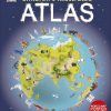
DK CHILDREN ILLUSTRATED ATLAS
₦16,000
This incredible and inspiring visual atlas takes you on a fact-filled, continent-by-continent tour of the world. Throughout the pages of this adventure book, you’ll discover more than 50 fascinating maps packed with fun facts and fresh images. Your child will learn all about the climate, populations, places, and industries of our world.
This incredible and inspiring visual atlas takes you on a fact-filled, continent-by-continent tour of the world. Throughout the pages of this adventure book, you’ll discover more than 50 fascinating maps packed with fun facts and fresh images. Your child will learn all about the climate, populations, places, and industries of our world.
Picture stories complement the maps, from the giant Amazon River flowing through the rainforest to the frozen icebergs of the glacial Arctic. Discover the richness and diversity of human and animal life around the globe. Each map shows countries with their capitals, famous landmarks, longest rivers, and highest mountains.
This educational book is more than an atlas! It also shows young explorers how to read a map and use a key, compass, and scale. It’s the ideal resource for classroom use, home learning, and armchair exploration.


Reviews
There are no reviews yet.